The length of the Black Sea from west to east is 1130 km, the greatest width is 613 km. From the south, the coast of Anatolia (the Asian part of Turkey) juts into it in a wide arc, and from the north the Crimean Peninsula cuts deeply. The shores are mountainous almost everywhere, there are few large bays and bays. The largest bays, such as Odessa, Karkinitsky, Tendrovsky, are inscribed in the low steppe shores of the northwestern part of the sea. Some of the bays are fenced off from the sea by wide sandy spits - barrows. Convenient bays Sevastopolskaya and Balaklavskaya are hidden among the rocks of mountain Crimea, and on the Taman Peninsula shallow bays are overgrown with reeds and reeds (floodplains). From the east, the Greater Caucasus ridges approach the sea, and even such large Perths as Tuapse, Novorossiysk, Batumi have only small bays. A large bay once existed where the largest of the rivers of the Caucasian coast, the Rion, flows into the sea. Later, on the site of the bay, a wide Colchis lowland was formed, and the Pontic mountains rise to the sea from the south. On the wide ledge of Anatolia there are three small peninsulas: the low-lying Bafra and Charshamba, and the mountainous Inje-burun with the Sinop Bay. The name of this bay recalls the victory of the Russian fleet under the command of PS Nakhimov in 1853, during the Crimean War. Less familiar are the names of the major ports of Turkey - Zanguldak, Samsun, Trabzon. Giresun, Ordu and the rivers Yesil-Irmak, Chorokh, Kyzyl-Irmak flowing from its territory into the Black Sea. The Thracian Peninsula (the European part of Turkey) has recently been connected to Anatolia by a huge bridge, under which large ocean-going ships pass freely through the Bosphorus. To the west of this strait, the spurs of the Balkans rise to the Black Sea - and here the mountains of Bulgaria's Sea Roads begin from the large ports of Burgas and Varna. Romania is crossed by the Lower Danube lowland going to the sea, along the low coast of which a chain of salt lakes stretches. Only the port of Constanta got a comfortable bay. On the northern border of Romania, the Danube Delta is widespread, and that is the entire Black Sea coastline, 4090 km away. Surrounded on all sides by land, it is one of the inland seas. At the same time, the Black Sea is "attributed" to the Atlantic Ocean basin: it connects with it through the Marmara and Mediterranean seas. On the area occupied by the Black Sea (423 thousand sq. Km), two Great Britains can be located. The water surface is only in some places near the coast interrupted by small islets, for example Berezan, located 13 km from Ochakov. Of the few Black Sea islets, the most distant from the coast is about. Serpentine (Fundonisi), located 40 km from the Danube Delta.
Length of the Black Sea from west to east - 1167 km, from north to south - 624 km. The maximum depth is 2,212 m, and the average is 1,271 m. The length of the coast along the perimeter is 4090 km, the length of the coastline reaches 4,340 km. The Black Sea area is 423,000 sq. km.
Due to the excess inflow of fresh waters of the Danube, Dniester, Dnieper, Southern Bug, Mzymta, Bzyb, Kodor, Inguri and others. (more than 300 rivers) above evaporation it has a lower salinity than the Mediterranean Sea. The rivers bring 346 cubic meters to the sea. km of fresh water and 340 cubic meters. km of salt water flows out of the Black Sea through the Bosphorus.
Depth of the Black Sea
Black Sea is one of the deepest sedimentary basins in the world. The thickness of sedimentary deposits at the bottom of the sea is 14 km. The bottom relief is a deep basin with steep slopes, its maximum depth is up to 2211 m. The area of \u200b\u200bthe Black Sea is 413 488 sq. M. km. The maximum length is 1148 km, the maximum width is 615 km, the length of the Black Sea coastline is 4077 km.
The Black Sea washes the shores of Russia, Abkhazia, Georgia, Turkey, Bulgaria, Ukraine.
There are few bays, bays and peninsulas in the Black Sea and almost no islands. This is due to the constant rise in sea level.
Black sea water composition
Salty taste sodium chloride gives seawater, and magnesium chloride and magnesium sulfate give a bitter taste. Water contains 60 different elements. But it is assumed that it contains all the elements found on Earth. Sea water has a number of medicinal properties. The salinity of the water is about 18%.
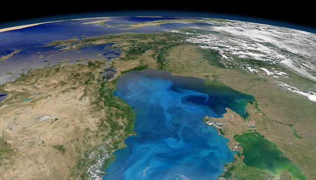
About 87% of the Black Sea water volume is deprived of oxygen and contaminated with hydrogen sulfide. At a depth of over 150 m, the water contains hydrogen sulfide, and therefore the sea is devoid of living organisms at great depths. The source of hydrogen sulfide is the decomposition of the remains of aquatic organisms; at a depth of 150-200 m, the content of hydrogen sulfide reaches 7.5 cubic meters. cm per liter of water, and its total amount is one billion tons. The uniqueness of the Black Sea lies in the fact that in the deep layers of its water there are no algae, invertebrates and fish, there are no living beings, except for sulfur bacteria.
Determined that age of the Black Sea about 8 thousand years.
Kalamitsky Bay is a part of the Black Sea, jutting into the western coast of the Crimean Peninsula between Capes Lucullus and Evpatoria. This bay is partially washed by the coast of Sevastopol in a small area from Cape Lukull to the administrative border with the Bakhchisarai district (only 1.5 km approximately). The entire area around Cape Lucullus is protected by the state as a nature reserve and is an object of a unique natural fund. The coastal aquatic complex occupies more than 125 hectares; it is a hydrological natural monument.
Kalamitsky Gulf. Geography
Kalamitsky Bay is a picturesque place. The width of the bay at the entrance is 41 km, 13 km from the entrance to the coast. The depth reaches 30 meters. The bay in the north rests on the city of Evpatoria. The shores in the south of the bay are clayey and high, in the north are sandy and low, where in many places there are beaches. Salt lakes are found not far from the coast, behind sandy barrows. The largest of them are:
- Saki,
- Sasyk,
- Gull,
- and also the curative lake Kyzyl-Yar.
Several rivers flow into the Kalamitsky Gulf (Belbek, Alma, Bulganak and Kacha). Directly on the shore of the bay there are several settlements visited by tourists, including Beregovoe, Uglovoe, Novofedorovka, Andreevka, Nikolaevka, etc.
There are different versions regarding the name of the bay. The most common one associates the name with the city of Calamita, which was built by the Genoese. The city has not survived to this day. Translated from Greek, Kalamita is translated as "good cape".
Attractions and places of rest
Not far from Cape Lukull is the Ust-Alminskoye settlement. This is a Scythian settlement that arose at the turn of the 2nd century BC. Its true name is not known. In fact, many ancient settlements existed in this part of Crimea, but not all have survived. For example, due to the collapse of the soil into the sea, more than half of the Ust-Alminskoye settlement were irretrievably lost. 

There are many private hotels and boarding houses along the coast of the bay. Tourists wishing to come here will find a place to stop.
Some of them, for example, the recreation center "Volna" (information on) are located near the sea, but also not far from lakes or estuaries.
The city of Evpatoria is considered a children's health resort precisely because of the favorable climate and shallow water of the Kalamitsky Gulf. The beaches are mostly sandy. The Kalamitsky Gulf warms up very quickly and often the swimming season begins in May and ends in September. 

Among the many seas of the world (there are more than 50 of them), a special group is made up of the so-called inland seas, to one degree or another surrounded by land. In this group, which in Europe alone includes the White, Baltic, Mediterranean and Marmara Seas, the Black Sea, in terms of the degree of isolation from the Ocean, is second only to the Azov Sea. In fact, it is separated from the Atlantic Ocean by the Bosphorus Strait, the Sea of \u200b\u200bMarmara, the Dardanelles, the Mediterranean Sea and the Strait of Gibraltar. An equally difficult waterway leads from the Black Sea to the Indian Ocean.
Dimensions: the surface area of \u200b\u200bthe Black Sea is 423,000 km2, and its water volume is 547,000 km2. The greatest depth is 2,212 m. The length of the Black Sea coastline, according to the latest estimates, reaches 4,340 km.
The Bosphorus Strait, or the Bosphorus, is, in fact, a narrow channel 31 km long, 35 to 0.7 km wide and a minimum depth of 50 m. On the opposite side of the Black Sea is the Kerch Strait, which connects it to the Sea of \u200b\u200bAzov. The length of this strait is about 45 km, width is from 3.5 to 42 km, and the minimum depth is only 10 m. However, the small Sea of \u200b\u200bAzov (the surface of about 39,000 km ") is shallow itself and the maximum depth of 13 m can be found in a very limited area in the very center of the reservoir.
The coastline of the sea forms several bays, peninsulas and headlands deeply protruding into the sea. The largest peninsula is Crimean, ending in the west with the Tarkhankut peninsula, and in the east with the Kerch peninsula. The Taman Peninsula is located on the eastern side of the Kerch Strait. The most prominent promontories are Kaliakra in Bulgaria, Media in Romania, Bolshoi Fontan, Tarkhankut, Chersonesos, Metanom and Chauda in Ukraine, Utrish and Myskhako in Russia, Pitsunda in Georgia, Cham, Bafra, Boztepe, Iceburun and Olujs in Turkey. The largest bays and bays: Burgas and Varna bays in Bulgaria, Mamaya bay in Romania, Odessa, Teidrovsky, Egorlytsky, Dzharylgachsky, Karkipitsky, Kalamitsky and Feodosiya bays in Ukraine, Novorossiyskaya and Gelendzhik bays in Russia, Samsunsky and Sinopsky bays in Turkey.
The landscape diversity of the Black Sea coast is very great. There are high mountains and vast valleys, humid areas with subtropical vegetation and arid regions, numerous estuaries, lagoons and river deltas.
The Black Sea is not rich in islands of continental origin. The largest of them, Zmeiny Island (in ancient times - Levka, Fidonisi), with an area of \u200b\u200b1.5 km and a height of up to 40 m above sea level, is located 37 km east of the Kiliya arm of the Danube delta. Another island, Berezan,
with an area of \u200b\u200babout 0.5 km "and a height of up to 20 m, is located 1 km from the mouth of the Berezansky estuary. Another island - Kefksn - is located near the coast, 90 km east of the entrance to the Bosphorus. Several very small islands, in fact, rocks , are available in the Burgas Bay.
Sandy islands, washed up by currents, can reach considerable sizes. These are: Tepdrovsky Island, or Tendrovskaya Spit, about 65 km long and about 30 km in area, Dzharylgach Island 42 km long, about 25 km in area, Dolgiy Island, 3.5 km in area, and some others, all in the northwestern part of the sea.
In any sea, there are shelves - continuation of continents under water. These are zones with depths less than 200-150 m. In the Black Sea, due to the peculiarities of its waters, the shelves are the only areas of the bottom inhabited by a rich life. The total area of \u200b\u200bthe Black Sea shelf is about 100,000 km ", of which 64,000 km" are located in the northwestern part of the sea, opposite the shores of Ukraine, Romania and Bulgaria. The shelf width here reaches 150-180 km. In other areas adjacent to mountainous terrain, the shelf narrows to 10, and in some places - to 2 km.
The central part of the sea - an area with depths of 2000-2212 m - is basically a flat bottom with insignificant depressions and elevations, covered with a layer of sediments with a thickness of 2 to 15 (!) Kilometers. Some researchers consider the Black Sea deep-water basin to be the remnant of the Tethys Sea.

The Black Sea, connecting through the Bosphorus and Dardanelles straits, as well as the Marmara and Mediterranean seas with the Atlantic Ocean, is strategically important for Russia. The coastline was conquered by the state, some territories remain the subject of disputes today.
Russian Black Sea coast

(Black Sea coast with resort cities of Russia)
The length of the Russian coastline of the Black Sea today is 1200 km. It starts from the Caucasus Mountains, continues along the coastal strip from Taman to Adler, and includes the Crimean coast.
Its relief is represented by the mountains of the Caucasus and the South Coast of the Crimea, lowlands and estuaries, mainly in the eastern part, as well as steep ledges. In general, the line is poorly indented, there is only one peninsula - Crimea. There are no islands in the Black Sea.
Russia's exit to the Black Sea
For the first time, Russia began to claim access to the Black Sea with the appropriation of coastal lands in the 18th century. It was a victorious war with Turkey, which resulted in the conquest of Anapa and the Crimean Peninsula. After that, at the beginning of the 19th century, the settlement of the conquered lands by Slavs began.
Crimea was given to Ukraine immediately after the collapse of the Soviet Union, but in 2014 the entire peninsula, including the Crimean Black Sea coast, became part of Russia again, and is the subject of disputes with Ukraine and the Western world.
Characteristics of the Black Sea

Depth: maximum 2210 m
Average water temperature (Black Sea coast, Russia): Winter 7.7 ° C, Summer 19 - 24 ° C
Coast: pebbles, gravel, sand and steep stone banks
Climate: mostly continental, the Black Sea coast of the Caucasus and Tuapse have a milder subtropical climate
The location of the coastline of the Russian Black Sea coast and the landscape features led to the formation of three climatic zones at once:
- humid subtropical;
- mediterranean;
- moderately marine.
The underwater world of the Black Sea is represented by dolphins and a species of shark - katrana. The latter are not dangerous for people. Among the commercial fish found in coastal waters, it is worth noting the flounder, goby and mullet.
Cities on the Black Sea in Russia

(Sandy sandy shores of Anapa)
Most of the cities on the Russian Black Sea coast have the status of resorts, due to the availability of appropriate resources and climatic conditions on the territory.
Anapa... The most western settlement among the cities of the mainland of the Russian Black Sea coast. At one time, the capture of the Anapa fortress allowed the Russian government to exercise control over the Black Sea. Today, it is a resort town.
Novorossiysk... The city does not have a resort status, despite the annual number of tourists. The settlement is surrounded on all sides by the mountains of the Caucasian ridge, but not high. The same relief is characteristic of the vicinity of Gelendzhik. The height of the mountains in the Gelendzhik region is greater.
Tuapse... It is the starting point of the Black Sea coast of the Caucasus. The resort is surrounded by high mountains.

Sochi... The largest and most equipped resort in the Russian Federation. Known all over the world. The length of the Greater Sochi coastline is over 100 km.
Kerch... The most eastern point of the Crimean coast. The city is located at the junction of the Black and Azov seas. In Kerch there is a ferry connecting the peninsula with the mainland of Russia.

(Stone coast of the Crimean peninsula)
Yalta... World famous resort city with a mild climate. Located surrounded by the high Crimean mountains.
Sevastopol... A city with federal status. The Black Sea Fleet of the Russian Navy is based in its bays. The city does not have the status of a resort, its infrastructure is designed to serve the base of the Russian Black Sea Fleet.
Evpatoria... The largest city on the western side of the Crimean coast. It is a health resort. There are many children's recreation centers and hospitals here. It is a recognized balneological resort.